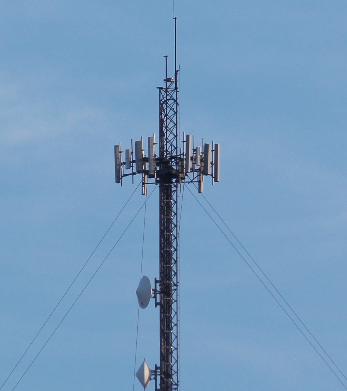
 Pictured is a closer view of the cell tower located on the mountain southeast of Tamaqua. The 180-foot tower was constructed in September 1997. Overall height, to include ground elevation, is 1,556 feet.
It is owned by “Cellco Partnership with Verizon Wireless”.
Click HERE to view the tower via Google Maps.
Information via AntennaSearch.com:
| Rep |
|
| Attn: |
Network Regulatory |
| Address: |
1120 Sanctuary Pkwy
Alpharetta, GA, 30009 |
|
|
|
| Owner |
|
| Attn: |
Network Regulatory |
| Address: |
1120 Sanctuary Pkwy
Alpharetta, GA, 30009 |
|
Tower Characteristics
| Registration #: |
1031355 |
| Latitude: |
40.7921 |
| Longitude: |
-75.9582 |
| Structure Type: |
Tower |
| Status: |
Constructed |
| Date Constructed: |
09/13/1997 |
|
| Ground Elev: |
1357.0 feet |
| Height Of Structure: |
180.1 feet |
| Overall Height: |
1556.2 feet |
| Structure Address: |
2 MILES SE OF I/S RT. 209 & RT. 309
TAMAQUA, PA |
|
History
| Purpose |
Status |
Date |
Addnl Info |
| New Reg |
Granted |
11/05/1997 |
— |
| Owner Change |
Granted |
02/28/2001 |
| Rep |
Verizon Wireless |
| Owner |
Cellco Partnership dba Verizon Wireless |
|
| Adm Update |
Granted |
10/08/2003 |
— |
| Adm Update |
Granted |
10/08/2003 |
— |
| Adm Update |
Granted |
10/21/2003 |
— |
| Modification |
Granted |
08/24/2004 |
— |
| Constructed |
Granted |
08/24/2004 |
— |
| Adm Update |
Granted |
11/28/2006 |
— |
| Adm Update |
Granted |
07/31/2013 |
— |
| Adm Update |
Granted |
01/04/2016 |
— |
Reference: http://www.antennasearch.com/sitestart.asp?sourcepagename=antennachecktowerreview&getpagename=pgtowerdetail_fcc&cmdrequest=getpage&ipos=1®istration_number=1031355
Other TamaquaArea.com photos of the tower:
 Pictured is a closer view of the cell tower located on the mountain southeast of Tamaqua. The 180-foot tower was constructed in September 1997. Overall height, to include ground elevation, is 1,556 feet.


