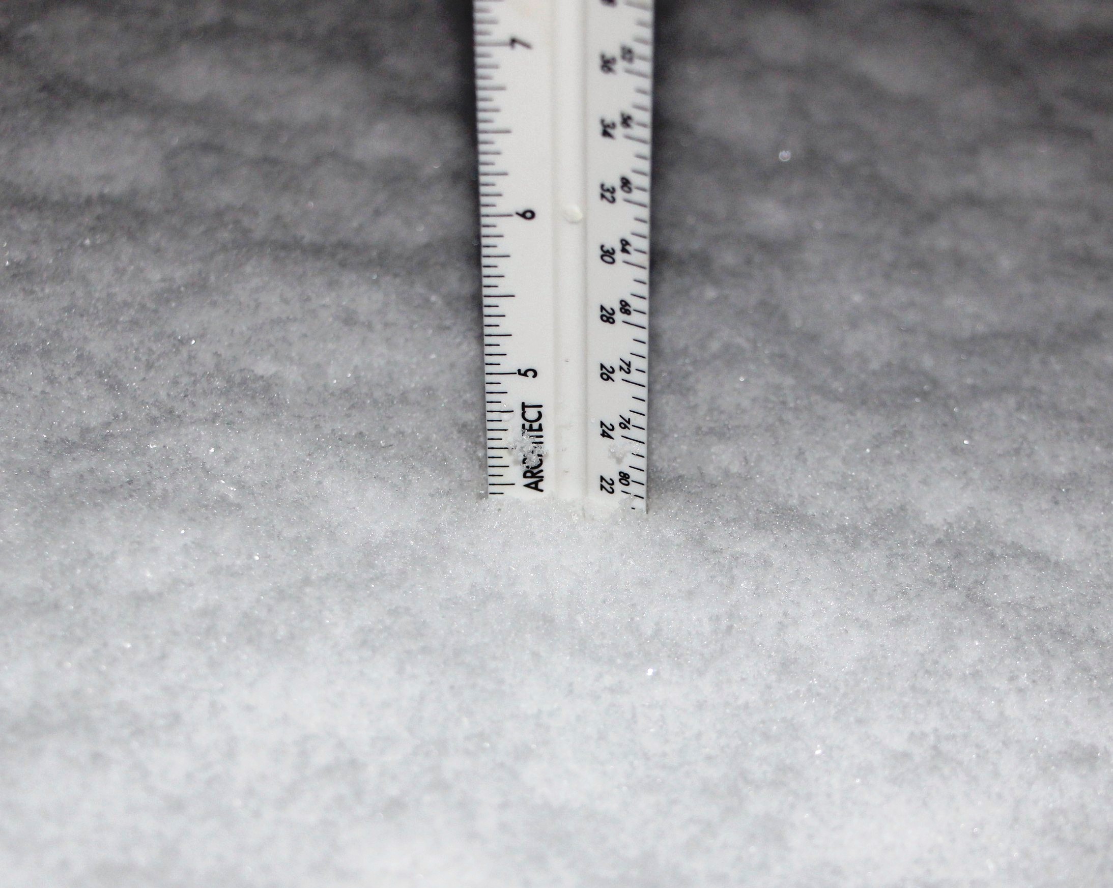
Just over 4 inches of snow had fallen over the Tamaqua area as of 6 AM today (Saturday, January 24, 2015). Light snow will continue falling off-and-on until around 9:00 AM. Expect wet snow, freezing drizzle and fog the rest of the day, ending around 6 PM.
Sunday calls for mostly cloudy weather with temperatures ranging from 15 and 31 degrees. Monday will bring similar temperature and the possibility of up to an inch of fresh snow.
At 4:13 AM today, the National Weather Service in State College PA issued a winter storm warning until 1 PM today.
It reads:
- … WINTER STORM WARNING REMAINS IN EFFECT UNTIL 1 PM EST THIS AFTERNOON…
- * LOCATIONS… THE SOUTH CENTRAL MOUNTAINS NORTHEAST INTO THE SUSQUEHANNA VALLEY.
- * HAZARD TYPE… SNOW.
- * ACCUMULATIONS… 4 TO 7 INCHES.
- * TIMING… THE HEAVIEST SNOW HAS ALREADY FALLEN FROM THIS STORM. LIGHT SNOW WILL CONTINUE TO FALL THROUGH THE MORNING HOURS WITH AN ADDITIONAL INCH OR SO OF ACCUMULATION BETWEEN 5 AM AND NOON. FROM HARRISBURG SOUTHWARD RAIN WILL MIX WITH THE SNOW AT TIMES.
- * IMPACTS… HAZARDOUS TRAVEL ON ROADS.
- * TEMPERATURES… IN THE LOWER 30S.
- PRECAUTIONARY/PREPAREDNESS ACTIONS…
- DANGEROUS WINTER WEATHER CONDITIONS ARE EXPECTED OR OCCURRING. USE EXTREME CAUTION IF TRAVELING. FOR THE LATEST WEATHER INFORMATION…
More Information
- .A FAST MOVING STORM SYSTEM NEAR THE DELMARVA PENINSULA EARLY THIS MORNING WILL TRACK NORTHEAST TOWARD NEW ENGLAND TODAY. SNOW OR MIXED PRECIPITATION WILL TAPER OFF THIS MORNING AS THE STORM PULLS AWAY.
Click HERE to view an interactive radar map via Weather.com.
