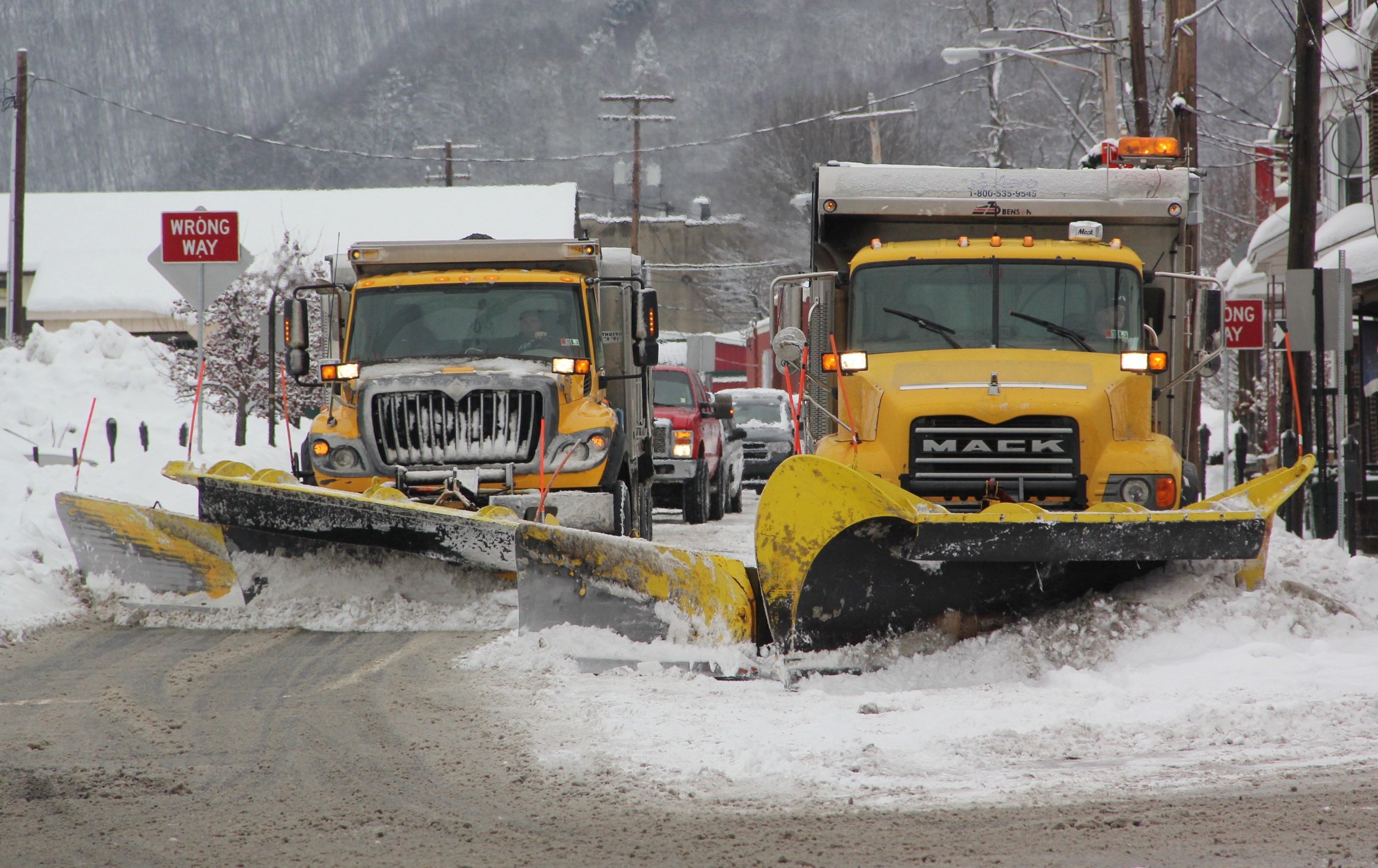
One of the busiest travel days of the year will be made more challenging as a winter storm impacts our area late Tuesday (November 25, 2014) into Wednesday. Heaviest accumulations are expected to fall Wednesday – tapering off into the evening.
Tuesday’s temperatures will range from 34 to 49 degrees Fahrenheit. Wednesday will bring colder temperatures in the low 30s and high 20s.
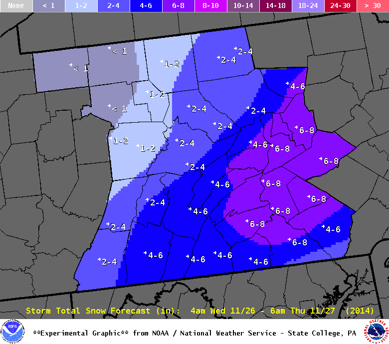
Weather predictions vary from 4 to 8 inches of snow accumulation. Guess we really won’t really know til it happens.
Click HERE to view the weather forecast via Weather.com.
Click HERE to view the weather forecast via the National Weather Service.
Below is the winter storm watch issued by the National Weather Service in State College:
- … WINTER STORM WATCH IN EFFECT FROM LATE TUESDAY NIGHT THROUGH WEDNESDAY EVENING…
- THE NATIONAL WEATHER SERVICE IN STATE COLLEGE HAS ISSUED A WINTER STORM WATCH… WHICH IS IN EFFECT FROM LATE TUESDAY NIGHT THROUGH WEDNESDAY EVENING.
- * LOCATIONS… MUCH OF SOUTH CENTRAL MOUNTAINS TO THE SUSQUEHANNA VALLEY AND POCONO PLATEAU.
- * HAZARD TYPES… HEAVY SNOW.
- * SNOW ACCUMULATIONS… 4 TO 8 INCHES.
- * TIMING… SNOW WILL BEGIN TO MOVE IN FROM THE SOUTH JUST BEFORE SUNRISE WEDNESDAY… INCREASING IN INTENSITY DURING THE DAY… BEFORE TAPERING OFF WEDNESDAY EVENING.
- * IMPACTS… SNOW COVERED ROADS. SIGNIFICANT IMPACT TO HOLIDAY TRAVEL.
- * WINDS… NORTHWEST 5 TO 10 MPH.
- * TEMPERATURES… IN THE LOWER TO MID 30S.
- PRECAUTIONARY/PREPAREDNESS ACTIONS…
- A WINTER STORM WATCH MEANS THERE IS A POTENTIAL FOR SIGNIFICANT SNOW… SLEET… OR ICE ACCUMULATIONS THAT MAY IMPACT TRAVEL.
